Chicago Braces for Dangerous Heat Wave With Feels-Like Temps Topping 100 Degrees Next Week
Chicago Braces for Dangerous Heat Wave With Feels-Like Temps Topping 100 Degrees Next Week
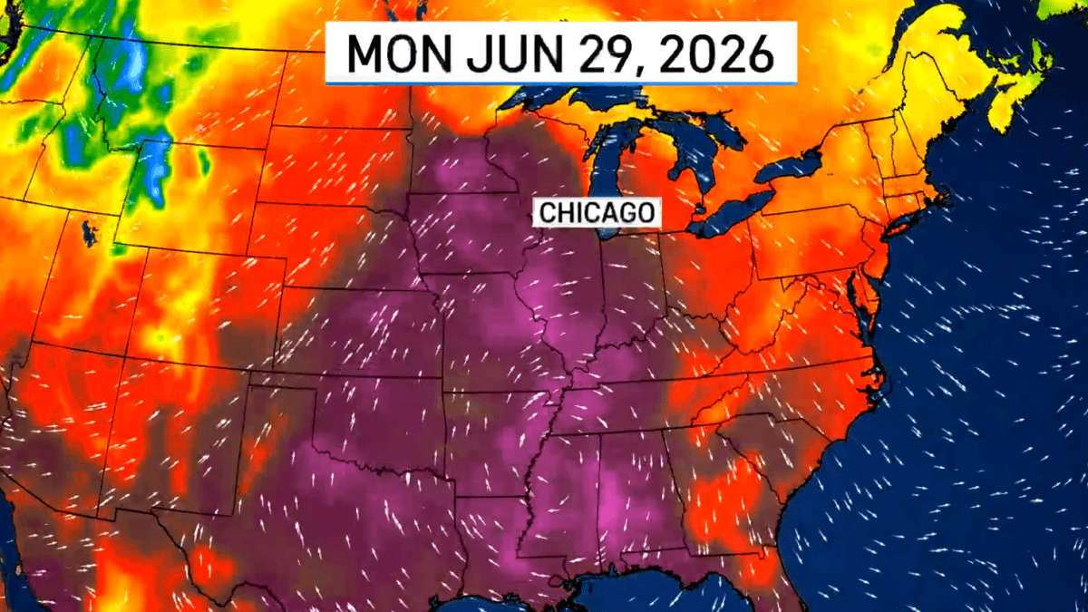
Chicago's summer just got a lot more intense. The city is on track to experience its first true heat wave of 2026 beginning as early as this weekend, with forecasters warning that a combination of high temperatures and suffocating humidity will make conditions feel dangerously hot well into next week.
What to Expect
Temperatures in Chicago are forecast to reach 90 degrees on Monday — only the second time the city has hit that mark this year — and the heat isn't expected to let up from there. Forecasters anticipate several consecutive days of 90-plus degree readings throughout the week.
While actual air temperatures are not expected to break all-time records, the real danger lies in the humidity. Dew point temperatures could climb into the mid-70s Monday and Tuesday, signaling exceptionally oppressive moisture levels for the Chicago area. When combined with the heat, feels-like temperatures — or heat index values — could reach 100 to 105 degrees each day.
The humidity begins building as early as Sunday afternoon, when heat indices are expected to climb into the lower and middle 90s.
Why This Heat Wave Is Especially Concerning
Meteorologists are urging residents not to underestimate this event, even if it doesn't shatter temperature records. Three compounding factors make it particularly risky:
- Duration: The heat is expected to persist across multiple consecutive days, not just a single afternoon spike.
- Lack of overnight relief: Nighttime temperatures are unlikely to drop enough to allow the body — or buildings — to recover adequately.
- Sudden onset: The Chicago area has been locked in a cooler-than-normal pattern for the past two weeks, meaning residents haven't had time to acclimate to the heat.
Storm Chances and Overnight Threats
A strong ridge of high pressure to the south will steer most storm systems around Illinois — through Iowa, Minnesota, and Wisconsin. However, forecasters note a possibility of overnight and early-morning thunderstorm clusters, known as mesoscale convective vortices (MCVs), pushing into northern Illinois. These systems are notoriously difficult to predict and can develop quickly, so residents are advised to check weather updates frequently throughout the week.
Looking Ahead
There is some hope on the horizon. A pattern change may arrive around the Fourth of July holiday, though forecasters caution it is too early to confirm the timing. A more meaningful shift is expected in the second week of July, which should bring conditions back to more typical summer weather for the region — not dramatically cooler, but a significant improvement from next week's dangerous heat.
Residents are encouraged to stay hydrated, limit outdoor activity during peak afternoon hours, check on elderly neighbors and family members, and take advantage of air-conditioned spaces during the height of the heat wave.